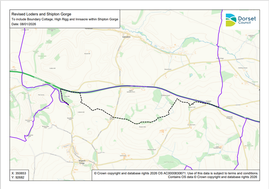
Appendix A: Proposed new boundary
Please note, the map may be difficult to access for some users so we have also provided the following location description:
Map showing the proposed new boundary between Loders and Shipton Gorge parishes. At the top of the map is shown the parish of Loders, with the parish of Shipton Gorge immediately below. Parts of adjoining parishes are also shown for context. The current parish boundaries are shown by a thick purple line. The proposed new boundary, to include Boundary Cottage, High Rigg and Innsacre within the parish of Shipton Gorge, is shown by a black dashed line. Place names and the names of some properties, such as farms, are shown, as well as the outlines of buildings, and roads and topographical features.
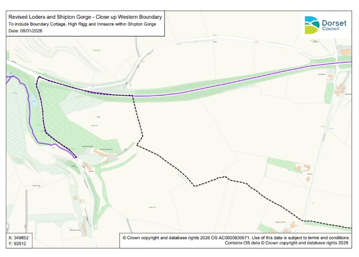
Appendix B: Closer detail of the western boundary
Please note, the map may be difficult to access for some users so we have also provided the following location description:
Map showing a close-up of the western line of the proposed new boundary between Loders and Shipton Gorge parishes. At the top of the map is shown the parish of Loders, with the parish of Shipton Gorge immediately below. The current parish boundary is shown by a thick purple line. The proposed new boundary is shown by a black dashed line. The names of some properties, such as farms, are shown, as well as the outlines of buildings, roads and topographical features.
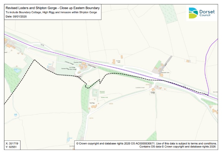
Appendix C: Closer detail of the eastern boundary
Please note, the map may be difficult to access for some users so we have also provided the following location description:
Map showing a close-up of the eastern line of the proposed new boundary between Loders and Shipton Gorge parishes. At the top of the map is shown the parish of Loders, with the parish of Shipton Gorge immediately below. The current parish boundary is shown by a thick purple line. The proposed new boundary is shown by a black dashed line. The names of some properties, such as farms, are shown, as well as the outlines of buildings, roads and topographical features.